


Geomorphology
)
)
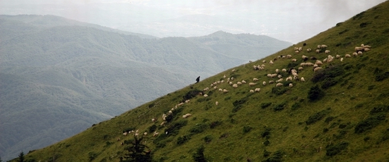
The main ridge is 14 km long, with homogenous characteristics only between the Costeşti Gorges and the Cheia Gorges, with a small suspension in the area of Curmatura Builei (where the sedimentary overlay was eroded up to the metamorphic deposits), the rest being fragmented by the rivers that carved gorges (from west to east: Bistriţa, Costeşti, Cheia and Olăneşti), that divide two massifs: Arnota (in the south-west, between the rivers Bistriţa andi Costeşti) and Stogu (north-east, between the rivers Cheia and Olăneşti), that look different from the main ridge. The ridge looks rather bumpy, with plane plateaus only on small areas (Mount Cacova and Mount Albu), the main characteristic being that of scale ridge, dominated by round peaks (Piatra, Buila) or sharp ones (Vânturariţa). The northern sector of the main summit area looks like a sharp crested ridge, even if its altitude is slowly going down. Erosion and degradation have detached residues shaped like needles or towers, some of which are large (35m), especially on the western side of massive. The secondary peaks are generally short (less than 1 km) and lower in large steps to the east. Only in Mount Cacova there are flat ridges, while the round ridges can be found in Mount Cacova and Piatra. The maximum altitude is located at the summit of Vânturariţa Mare (1885 m), and the minimum at the draining of Bistrita River from its gorges (550 m). The average elevations results at 1218 m. The curves level and the hipsometry in the Massif lay length concentrically. Thus, the altitudes over 1800 m are only laying on two small areas in the centre of the Massive, around Buila and Vanturarita peaks, summing up only 1.4% of the total surface. The whole central part of the massif and the island of Mount Stogu reach between 1400 and 1800 m, which represent 14.5% of the surface. The largest scale is that of 1000 - 1400 m, found in Mount Arnota and Mount Cacova, but also along the eastern border of the central and northern part of the Massif. This altitude interval represents 56.6% of the surface. The part under 1000 m takes about 27.3% of the surface and it is present especially in the southern part of Mount Arnoa and along the valleys of Bistriţa, Costeşti and Cheia rivers. ) Values lower than 2 km/sq represent 20.8% of the surface of the massive. The minimum value was calculated at 0.9% km/sq, in the area of the Bistrita limestone carrier. Except the allochthoneous valleys of the rivers Bistriţa, Costeşti, Cheia and Olăneşti, the valleys of permanent flowing waters are almost missing. Because of that, the highest percentage in the calculations comes from the torrential organisms and the avalanche valleys on the abrupt slopes. The deepness of fragmentation of the relief reaches a maximum of 820 m. The medium energy is 518 m and the minimum is around 350 m, which are the usual values for average altitude mountains. On more than half of the surface of the massive, the energy of the relief is under 500 m, respectively 24% of the surface under 400 m and 33 % between 400 and 500 m. The areas within 500 to 600 m represent 15% of the surface of the massive, while the energy within 600 to 700 m means 13.5%. The highest values, of over 700 m, are 14.5% of the surface. In most of the cases, the usual values are high due to the perspective of the valleys in relation with the slopes that border the main ridge of the massif. ) The same wide variety is seen in the display of the slopes. The horizontal and sub-horizontal surfaces represent only 6% of the surface of the massif. Surfaces exposed over the east and south cover 25%, respectively, 32% of the surface, while the western ones cover 18% and the northern ones 19%.
Maps made by Kogayon Association under the Project "Implementing the European Ecologic Network NATURE 2000 on the territory of the National Park Buila-Vânturariţa and elaborating the Management Plan of the Park" financed by Environmental Administration Found and cofinanced by RNP Romsilva
|

 |
|
 |
||||||||||