Hiking duration:
- on summer: 4- 5 h
- on winter: forbidden on the Trail of the Goats
Refuges: the Iezer Hermitage, the Codric Forestry Station, the Cheia Refuge
Water sources: the Iezer Hermitage, the Codric Forestry Station
Description:
The trail connects the Cheia village to the north-western slope of the Buila-Vânturariţa Massif. It is rated as an easy trail on its first track, as it follows a forestry road, but rated as highly difficult on the last track, on the Goats’ Trail, a trail with many exposed sections, forbidden on winter. We recommend hiking on this section only to experienced hikers, while for the others there is another option, longer but safer and much easier: trail no. 13, marked with an yellow cross, that goes to the Cheia Chalet on the forestry road.
The trail starts from the Cheia village, where there is an arrow-pointer. On a 9 km section of the forestry road, the trail coincides with trail no. 8, marked with a red cross, that goes from the Bărbăteşti village to the Pahomie and Pătrunsa Hermitages. 3 km away from the start point, there is the Iezer Hermitage, then, on the left, a refuge, a forestry station, and the Călăuzul Mare Valley, the Wolf Valley and the Cracul Tisei Valley and, 9 km further, there comes the crossroad with the path that goes to the Pahomie Hermitage, where the trail nr. 8, marked with a red cross, takes a different direction. There is a cross-shelter here, an information panel and an arrow-pointer.
Following the forestry road on the Cheia Valley, you’ll pass some ruins and a crossroad with another forestry road, coming from the left (Valea Neagră), wherefrom you enter into the Buila-Vânturariţa National Park (the boundary line is marked by the white framed red square) and after another 4 km, you’ll get to an arrow-pointer, wherefrom the trail separates from the forestry road. The one that keeps following the road is trail no. 13, marked with an yellow cross.
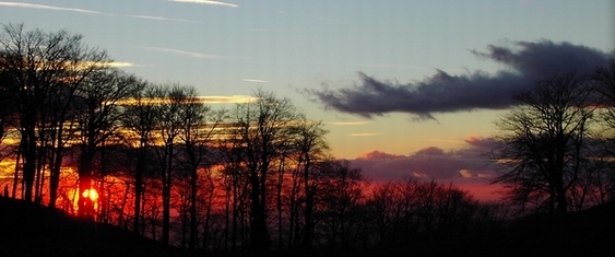
From the crossroad, our trail goes upwards into the woods and gets onto a small plateau, across the Codric forestry station. Going up to the left on the ridge, through the forestry exploitation area, you’ll get at the bottom of the cliffs in 30 minutes. Track course changes from hereon to the right, on a level curve. After another 10 minutes, where the Trail of the Goats begins. This trail ascends through a detritus area, at the bottom of the limestone wall and then, through the woods, up to a ridge. Going up for another 20 m, to the right, you’ll find a small knob, where from you’ll get a good view to the Cheia Gorge and to the Cozia and Narăţ Massifs. The narrow path goes on through the woods, close to the wall, crosses an exposed area, with no vegetation, and goes back into the woods, and then goes down on a steep and dangerous area, with a few roots to hold on to for support. Going on the narrow trail, you’ll find only a few spruces and silver birches to hold on to and, 30-40 minutes after the entrance on the Goats’ Trail, you’ll get to another place with a great view on the entire gorge sector. The trail goes downwards to the left, crosses a steep valley of detritus; you’ll have to descend along the left wall after crossing this valley, and then go down to the stream course, in a winding road. Cross another detritus valley and then a section of big fallen limestone rocks and, then, go down close to the waterfalls. From the river, you’ll start going upwards again, passing among the big limestone blocks, until you’ll get to the area where the river stills down, where you’ll know that you have reached the end of the gorge and of the limestone section. The trail becomes obvious and proceeds on the river’s bank through the forest. Going round the Santinela Cheii Peak, you’ll cross over a spring and, after 10 more minutes of walking through the woods, you’ll get to the Cheia refuge, located right on the left bank of the Comarnice Stream, surrounded by limestone formations: Mount Stogu to the north-east, the Stogşoare Massif to the east, Mount Claia Strâmbă and Santinela Cheii Peak to the south.


)