Hiking duration:
- on summer: 6 – 6 ½ h
- on winter: 8 – 9 h
Refuges: Comanca Forestry Station, Mânzu Forestry Station, Prislopel Pass refuge, Cheia Chalet
Water sources: Comanca Forestry Station, Mânzu Forestry Station, Prislopel Pass refuge, Cheia Chalet
Description:
This is one of the 4 trails that connect Băile Olăneşti city to the Buila-Vânturariţa National Park.
It is rated as an easy trail, as the hiker gets to walk mainly on forestry roads, with insignificant altitude ranges, accessible on summer as well as on winter.
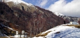
The trail starts from the center of the tourist resort (430 – 520 m), going on the street that goes up nearby the park to spring nr. 24; 2 km further, you’ll see the Comanca camp and chalet. Before the bridge over the Olăneşti River, there is the arrow-pointer that marks the crossroad with trails no. 15 – red cross – and no. 19 – blue cross – both of them going up on the intervalley between Olăneşti and Cheia. Cross the bridge and follow the forestry road along the Olăneşti Valley. The trail goes united from here to the Mânzu Forestry Station with trail no. 16, marked by an yellow triangle. You’ll pass by a water caption station and, 1 km further down the road, get at the Comanca glades, where there is a church and a few chalets. Cross the river, and after another 500 m, you’ll get to the Comanca Forestry Station (information panel). Before the confluence with the Radiţa Valley, where you’ll get after another 2 km’s walk, the road gets into the middle gorge of the Olăneşti Valley. After the confluence, the valley is narrow and there is a gorge section again. Passing on the left bank, the river accompanies the road with many waterfalls. You’ll walk past Mount Alionte, that stands sharp and steep, making forcing the river to twist. 6 km away from the confluence, you’ll see the Mânzu Forestry Station (710 m), where the trails separate (arrow-pointer), and trail nr. 16, marked with an yellow triangle, keeps going on the Olăneşti Valley.
From the Mânzu Forestry Station, you’ll leave the forestry road behind. Cross the river 20 m upstream from the forestry station and go upwards, to the west, on the slope to the Prislopel Plateau, through the spruce forest. You’ll go round the northern corner of a nursery, and then proceed with the ascent, paralelly to the Prislopel spring, first on the slope, then on a ridge, and, after 15 more minutes, you’ll get to the top ridge that separates the Olăneşti and Cheia valleys, the Prislopel Pass (800 m). There is a small shelter here, and an arrow-pointer, signing up the crossroad with trails nr. 15, marked by a red cross, and trail nr. 19, marked with a blue cross, that comes up here from Băile Olăneşti along the intervalley, going respectively towards the Cheia Chalet (coinciding with our trail from hereon) and to the main ridge of Căpăţânii Mountains (joined with our trail from here to the At the Lake Pass). Here there is also the boundary of the Buila-Vânturariţa National Park, signed with the white framed red square, that goes on the same track as the tourist trails up to the At the Lake Pass.
From the Prislopel Pass, the trail changes course to the north, goes up the edge of a glade up to a small top, and then proceed on the ridge, towards Mount Sterpu, with old beech forest on the left, and young forests on the right. After 30 minutes, you’ll get on a tractor road and, after 5 more minutes walking on it, you’ll get to the At the Lake Pass (820 m), where you’ll come across the road that goes up on the Cheia Valley (trail no. 13, marked with an yellow cross).
From the At the Lake Pass, the trail joins trail nr. 13 – an yellow cross (go to the description), and trail nr. 15 – a red cross.


)