Hiking duration:
- on summer : 6 ½ - 7 h
- on winter: not recommended
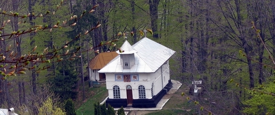
Refuges: Refuges: Cheia Chalet, the Old Sheepfold
Water Sources: Cheia Chalet, the Old Sheepfold
Description:
The trail connects the Buila-Vânturariţa Massif with the Căpăţânii Mountains, through the Hădărău Plateau.
From the Cheia Chalet the trail follows the forestry road to the north, crosses the Cheia river, passes the intersection (arrow-pointer) with trails no. 14 (yellow line) and 15 (red cross), crosses the river and turns back on the left bank, and then leaves the valley to go up the road to the south. After 5 minutes, you’ll get where an arrow-pointer directs you to leave the road. Up to here, the trail overlaps with trail no. 13, marked with the yellow cross. From the arrow-pointer, you go up into the woods on the slopes of Mount Hădărău. After a big number of curves along an old winding tractor road, sometimes hard to distinguish, after 2 - 2 ½ hours since the departure, you’ll get to the Hădărău Glade and Saddle (1320 m). There is an arrow-pointer here, marking the crossroad with trail 19, marked with the blue cross, that ascends from Băile Olăneşti, the two trails being joined up to the Gera Peak, where they both end, in the main ridge of the Căpăţânii Mountains.
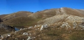
If up to here you walked on an old, hard to follow, tractor road, you’ll find the trail is very clear from hereon. From the glade, the trail goes to the north and enters the beech forest on the eastern side of Mount Căprăreasa. The road, carved in the cliffs now and then, will take you, after a slow ascent, out in some points where you get a good view to the Stogu (south) and Folea Peaks (east). After a 40 minutes’ walk from the Hădărău Saddle, you’ll get into a young spruce forest. On the right side, you’ll leave behind a small glade where there are some ruins of a building, then ascend on a winding road and restart ascending up the slope and, after 30 more minutes, you’ll get to a spring (cca. 1600 m). The path goes downwards for a bit, to a valley, then into a glade. You’ll continue the ascent by the left corner of the glade, get back into the spruce forest and, a few hundred meters further, you’ll get into a bigger glade, that goes up to the top of the Bogdana Mare Peak. The trail goes upwards through the forest, along the source of the Olăneşti stream and right at its origins, you’ll get into the alpine meadows. At the bottom of the valley, there are two shelters of an old sheepfold. From here, you will ascend on the grassy southern slope of the Gera Peak (1890 m), the end point of the trail.


)