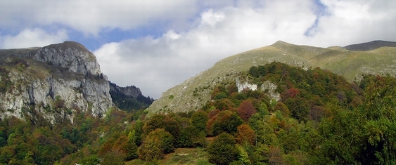
NEWS

The English version of the Buila-Vanturarita National Park web page - September 2007

details

CONTACT

Address:
Pietei 7, Horezu Town, Valcea County

Tel.: 0250/860.157
Fax: 0250/860.180
Email:office@buila.ro

Speleology

The limestone ridge of Buila-Vânturariţa Massif, due to its south-west to north-east direction, represents a barrier for the rivers that collect the waters of the southern slopes of the Căpăţânii Mountains. Rivers, having to go around the central area, managed to pass through this barrier only at the two ends: in south-west the rivers Bistriţa and Costeşti carved a spectacular gorge where Mount Arnota is also comprised, and in the north-east, rivers Cheia and Olăneşti carved Comarnicelor Gorge (also called Recea Gorge or Cheii Gorge), one of the deepest and wildest in the country, with 1 km of waterfalls, erosional holes, steps, walls as narrow as 2 m and as tall as 300 m, and respectively Mânzului Gorge (Olăneştilor Gorge, Folea Gorge, the Bad Valley or the Dry River Gorge).

Beside the gorge, the exokarst is poor in numbers, variety and dimensions, because of the structure of the limestones. There is the limestone blocks field in Mount Albu, a few natural arcades, like the House of Stone above Pătrunsa Monastery is the mostly known, the horns at Curmătura Builei and the north-western slope.
The endokarst are much better represented, by over 100 caves and a few vertical caves.
Beside the gorges, the exokarst is poor in numbers, variety and dimensions, because of the structure of the limestones. There is the limestone bloks field in Mount Albu, a few natural arcades, like the House of Stone above Pătrunsa Monastery is the mostly known, the horns at Curmătura Builei and the north-western slope.
The endokarst are much better represented, by over 100 caves and a few vertical caves.

Buila-Vânturariţa Massif is the furthest east in the Middle Carpathians that fosters a caving micro fauna. For that reason and because of the large number of caving micro fauna species, the massif is very important under the biospeleontological aspect.

Buila-Vânturariţa Massif is the furthest east in the Middle Carpathians that fosters a caving micro fauna. For that reason and because of the large number of caving micro fauna species, the massif is very important under the biospeleontological aspect.

Ten of the park's caves are natural protected areas by Low no. 5/2000:

The Cave of Bats (St. Gregory the Decapolite)
The cave is located on the right slope of the Bistri?a Gorge, at 630 m absolute altitude and 80 m relative altitude, with an easy access, on a trail that ascends starting round the back of the Bistri?a Monastery...
details...
The Arnăuţilor Cave
It is located on the right slope of the Mânzului (Olăneşti) Gorge, at 1000 m absolute altitudine and 60 m distance from the lowest point of the valley. Its length goes arround 150 m and the wideness is around 24/15 m, positioned on the north-western course, easy to spot from the valley, placed on a rather abrupt wall-cliff...
details...
The Green Lake Cave
It is located on the western wall of Mount StogÅŸoare, at 990 m absolute altitude and 140 m relative altitude to the Cheia river, on the western slope of the detritic area called OgaÅŸul Ursului...
details...
The Cave of Pagodas
The cave is situated on the western wall of Mount StogÅŸoare, at 150 m relative altitude from the Cheia valley...
details...
The Cave in the Comarnicelor Gorge (Munteanu Murgoci)
It is located in the StogÅŸoare Massif, at 930 m absolute altitude and 30 m from the Cheia valley lowest point, on the western slope of the gorge. It was studied and described since 1898 by Gh. Munteanu-Murgoci...
details...
The Cave of Goats
details...
The Cancer Cave
details...
The Bistriţa Valley Cave
details...
The Cave with Pearls
details...
The Bell Cave
details...

Page made by Kogayon Association from
Environmental Administration Found project

Page translated by Daniela Sargu & Alan Kerslake